Wednesday, June 20, 2018

Hike to Kvitenosi (mountain) in Norway - Close to Voss

I have been many times to this mountain, lived for some years in Voss, a small city close to Bergen in Norway. One reason to visit this mountain is to see a German warplane from WWII that crash landed near the peak. Two out of 6 survived the crash. One might still find pieces of the plane, but most of it has been sent to Germany where they have tried to reconstruct it.

The easiest way to hike to Kvitenosi is to drive from Voss to Evanger on E 16. Turn off to the right and you will find Teigedalsvegen. Follow this road until the junction with FV 313 (Brekkhu), dont go there but turn right. The road will eventually turn into a dirt road and climb up into the mountain. It ends just below a dam at Volavatnet.
Here is the road from Evanger approximated with a blue line.

The trail is not easy to spot. Cross over to the other side. There you should turn down to the left to find the trail. There are no signs, but sometimes there are round circles painted on stones. On the plotted trail below you will see the Vola lake at the bottom and the blue flag is the peak of the mountain. The plane is somewhere on the flat part before the blue flag.
From the map you can see that it is an easy hike, half way you have to cross a creek, you might have to take off your shoes to get to the other side. This trip was in August, and there is still a lot of snow in this area and altitude (on the map it is shown in meters). If you bring a GPS or a good topo map you can return by going around the mountain back to the dam. On that side there is an unmanned tourist cabin where it is possible to stay overnight. 
This is the dam and you see the bridge to cross the flow of water running from the dam.

This is how the trail looks like, and you should head up to the left of the mountain in the picture.

And just get used to it, walking on snow.

After the first climbing, it flattens out towards the creek you have to cross.

Here is a steep part up to the top plateau, see the round circles on the stones and rocks.

Here is part of the plane.
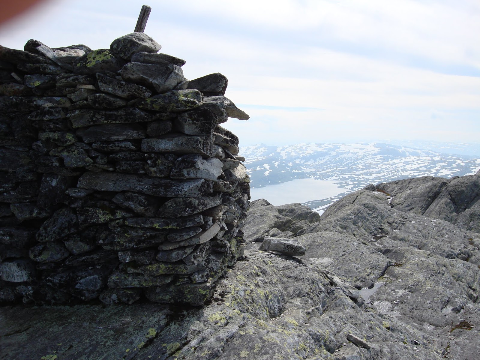
And of top of the mountain you have this big pile of stones.

If you chose to walk back on the other side, this is how it looks, a lot of snow.

Be careful where you see water like her, you dont see how deep it is, could be part of a creek or a lake.

Here is the cabin that is for the public to use. If you intend to stay you need to get a key at a tourist office before you go, the cabin can be locked.

On this side of the mountain there are several trail so other parts of this mountain range, and there is trout in the lakes.

Here you see the dam where you started.

Here you can see the elevation along the trail. This graph is if you return the way you came.

Voss is a great location for hiking, biking and watersport. Also many places where you can do base jumping from mountain cliffs. Many trails starts from the city, but driving less than an hour and you will have many more. The most famous event might be the Extreme Sport Week in summer.


Saturday, June 16, 2018

Hiking the Scout Cave Trail in Snow Canyon State Park Utah

Todays hikeThis trail is starting just outside Snow Canyon State Park in St George. Drive towards Snow Canyon State Park. When you are about a quarter mile from the State Park entrance, there is a parking space on the left hand side of the road. Park here, and walk across the road and you will see the trailhead entrance. This is the start of two trails, Johnson trail which is closed much of the year because of birds nesting.
The trail look closed, buy continue to the sign showing Scout trail, it is to the right. Then you will be guided all the way to the Scouts Caves. Its a nice trail through the dessert, down to the bottom of the river, normally dry. Then up towards the red cliffs, and you can go inside the caves. They are not big, but it is nice view from inside out.
It is an easy trail to walk, round trip is just under 4 miles depending how much you roam around the caves area. As usual, in June July and August it can be pretty warm. But being under 4 miles I would say a 20 oz. bottle of water will be sufficient. It is not much wildlife to see in the warm season, mostly lizards, dragonflies, birds. In May you might see a lot of flowers.


Here you come to a junction. The Johnson trail straight ahead is closed much of the year when birds are nesting. So turn right here.

Below the red cliffs is a lush green bottom, river that eventually will flow down to Santa Clara River, and that is dry much of the year.

If you watch ahead of you on the trail you will see some insects, like this fly, it disappears into the hole and comes out again in a few seconds. How does it turn around in that tiny hole being that long. I guess it is a lot of underground life in the dessert in the heat. It is a Thread Waisted Wasp. They kill their preys and store them underground!

Here is where you walk down to the river area.

A nice lizard. When you see a running lizard, just stop. And it will stop some place away from you. Then you can move slowly towards it, and it will stay put. You can move as close as maybe 6 feet away. This is the Western Zebra tailed lizard. It is common in the south west of USA.

So it is possible to get a good picture with a 250 zoom lens.

The trail at the bottom of the river is nice, partly whit, could it be salt or is it blue clay?

Another lizard, just watching you not moving too fast.

Here you see the caves affront you, you have to get up there, its easy, even steps made for you.

A closer look.

A lot of hodos around?

This is the cave, not big. Did not see any bats, the usually take shelter in caves.

A nice view from inside the cave, its towards Ivins/Santa Clara.

White trail bottom.

A Blue dragonfly on the flowers.


Colorful moss.

And look who is watching you.

Friday, June 8, 2018

Hike to Signal Peak on June 8

Today I had a newly charged GPS and intended to reach Signal Peak. I started 10:24 am from the Forsyth trailhead in Pine Valley, Utah. Since I had walked the trail 3 times already I continued up to where the trail is at elevation 10160 feet. This is where the trail to Burger Peak takes off to the left. The trail soon disappears, but it is easy to find the top, just to walk up and up.

But today I continued straight ahead to reach Signal Peak. I could see that one had to descend somewhat before heading towards Signal Peak. At elevation 10015 feet I found a lot of rock stables and this might have been put there to tell you this is the place to leave the trail. So I did, but from there on it was no tracks, you just had to look at your GPS and look at the terrain where to head. I picked a route that ascended slowly upwards, I had to jump over or walk around some fallen trees, but it was not too bad. But you walk in a thick forest and you can not see the top, but you know you are close when the grade flattens out.

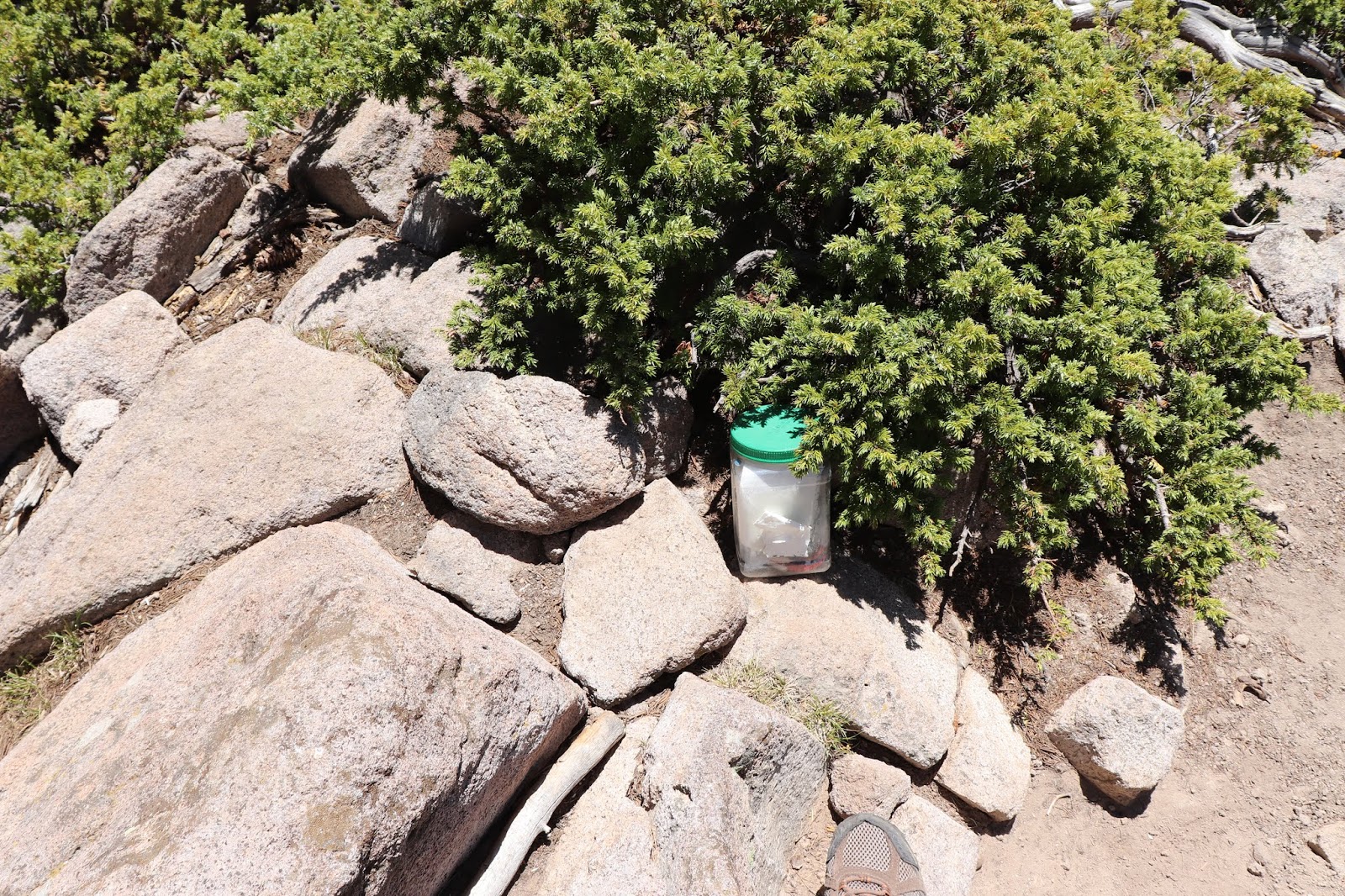
The top has a lot of stony areas and it is hard to find out what is the highest point. I walked around for a while and suddenly I spotted a plastic jar, containing a book and a pen for you to write in, so I did. From that point you can not see much, I did not try to walk downwards south to see if it was a better view somewhere.

So if you know the route, have a GPS or a good map it is easy to reach the peak. It took me 3 hours and 15 minutes to reach the top. It was a 13 mile hike back and forth.
The waypoint 003 is where a trail takes off to the left that goes to Burger Peak. That trail soon disappears, but it is easy to just go upwards and you will find the peak.
The graph shows the grade and elevation of the hike.
This is the place where the trail flattens out at a little over 1100 feet.
 Here you can see the tiny trail that takes off to the left to reach Burger Peak. If you want to do Signal Peak also, dont try to go down another way, retreat to this same spot and continue on the original trail.
 Watch where you are walking it is easy to loose the trail.
 Here is a photo of the right side of Signal Peak. Dont head for it, it is a dip there before you can ascend. So continue the trail forwards and downwards.

When you have descended to elevation 10015 feet, you will see these tables of stones. This a convenient place to take off to the right to head for Signal Peak.
 After a while and a climb of 350 feet, the upward grade flattens out. On your way you will probably not see any trail and you might have to do som zig zag to pass fallen trees. But when you reach the top it looks like this, a lot of stones. But you are still surrounded by the trees.
 It is hardly anything to see from the top, and you might wonder where the highest point is, it is pretty flat.
 I guess this plastic jar is at the top. Inside is a thick book and a ball pen so you can write about your hike to here.

 A nice picture?

 People are horsback riding up the trail, but they do not ride to the peaks, just follows the trail and camp overnight on the trails campgrounds. This is about elevation 1100 feet.

 When you walk back down the trail you will have many nice views to west and north.

The descent is many places steep, so the time to go down is only a little quicker than going up.